Sargent Town Planning (STP) was selected by the City of San Fernando to prepare new transit-oriented development (T.O.D.) overlay zoning for their historic downtown. The work was done under a funding grant from the Los Angeles County Metropolitan Transit Authority (Metro), which operatea the existing Sylmar/San Fernando Metrolink station, and are planning a new light rail line connecting from there down Van Nuys Boulevard to the Van Nuys Orange Line and Amtrak/Metrolink stations. The main goals of the Plan are to better leverage the value of the existing and planned transit services to new build value and community life in downtown San Fernando while delivering more riders to the transit, thereby reducing regional greenhouse gas emissions and traffic congestion.
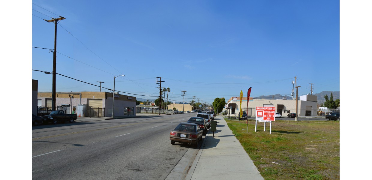
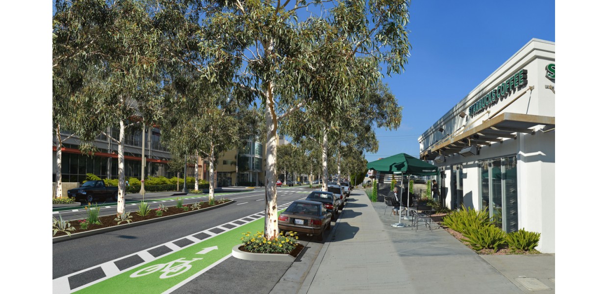
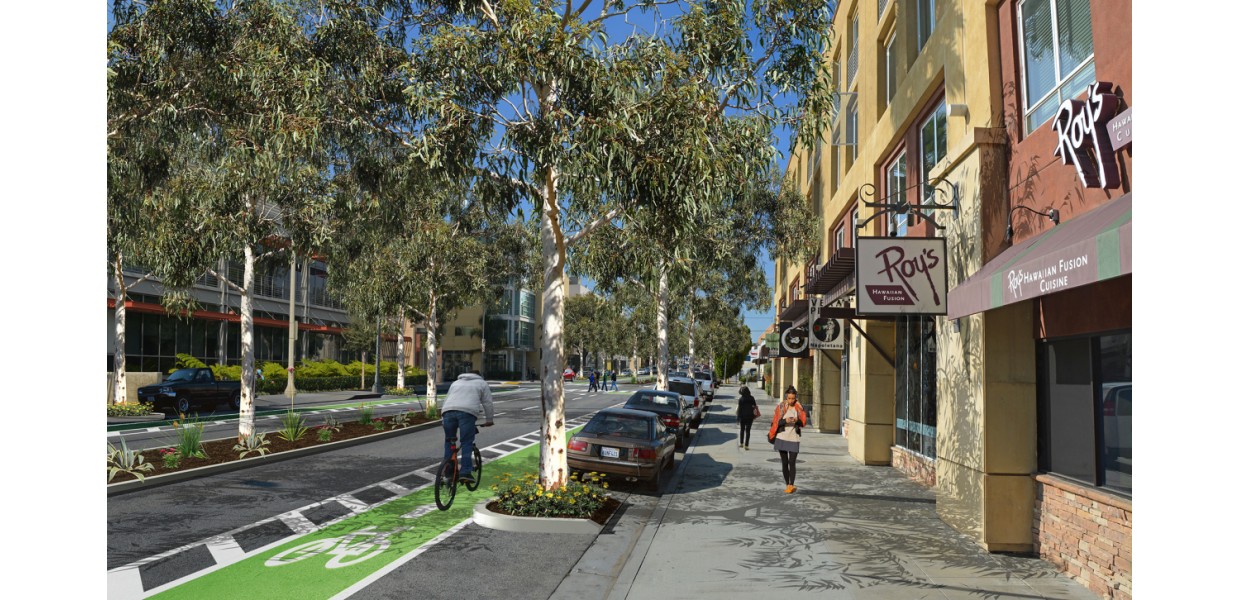
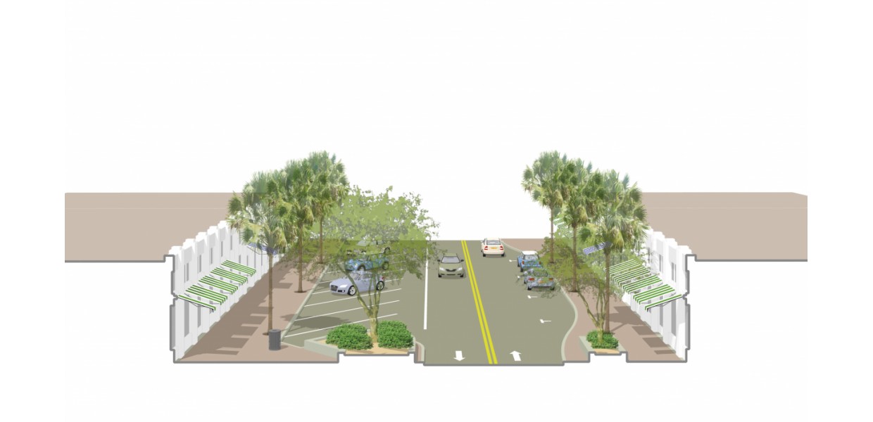
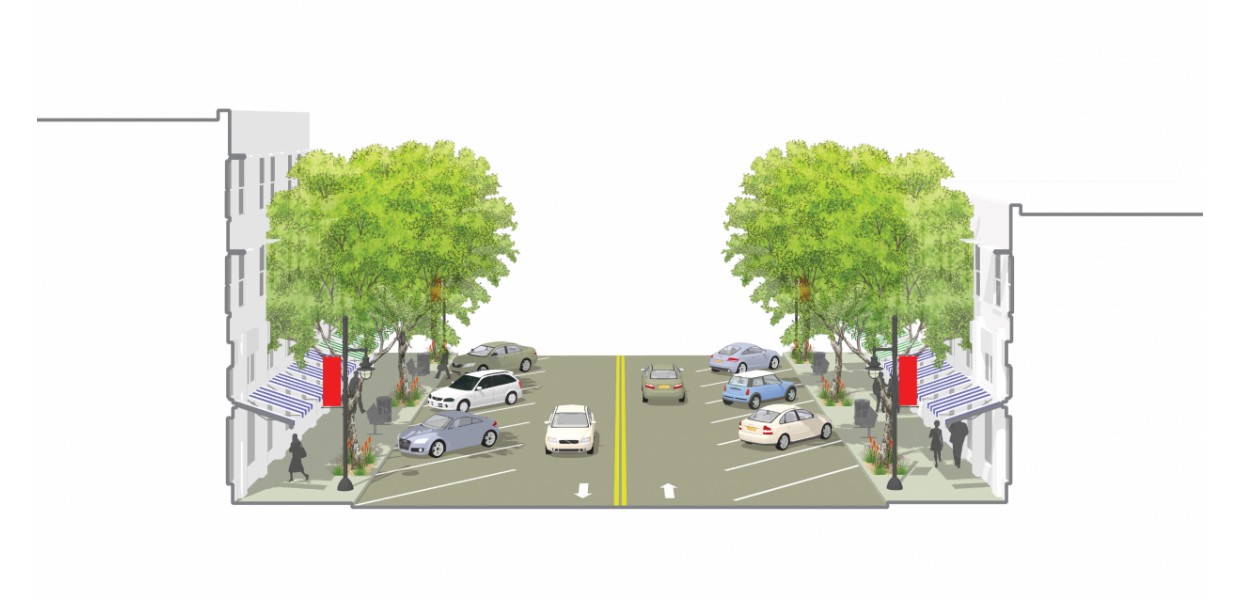
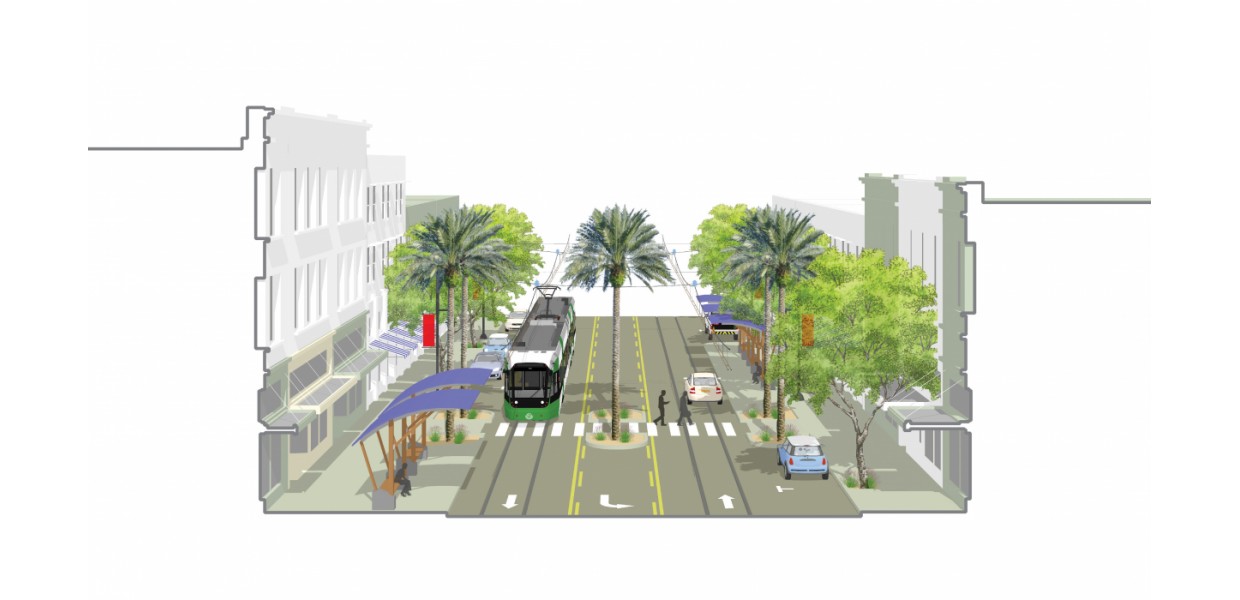
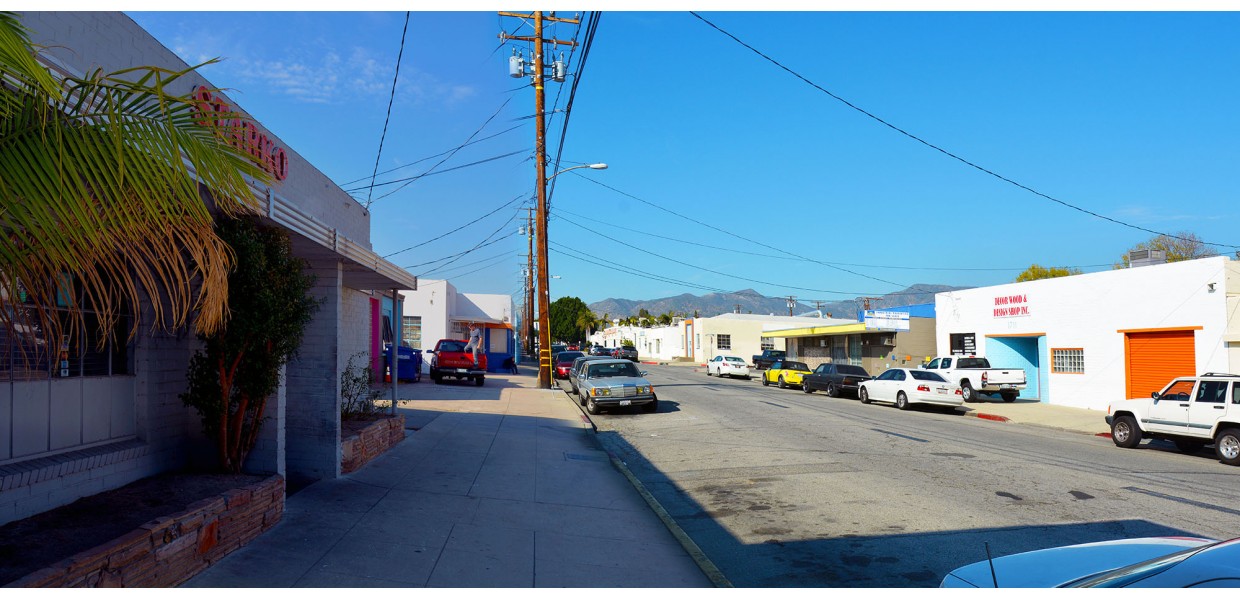
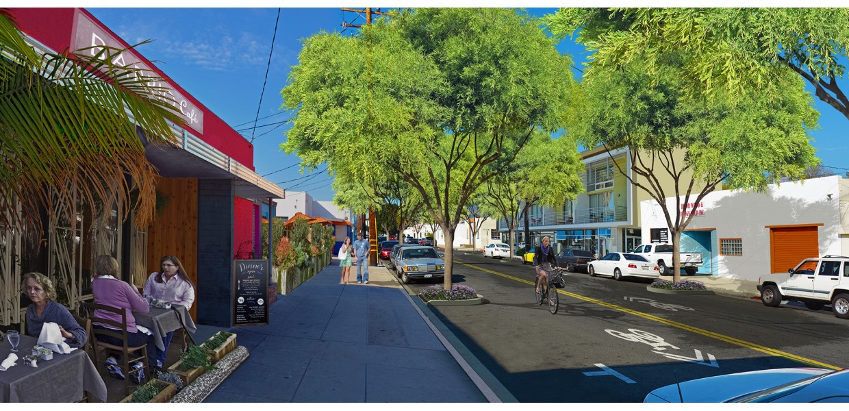
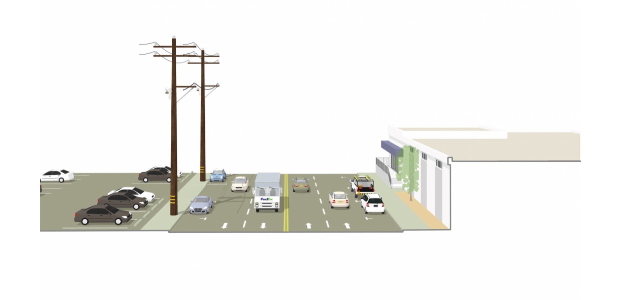
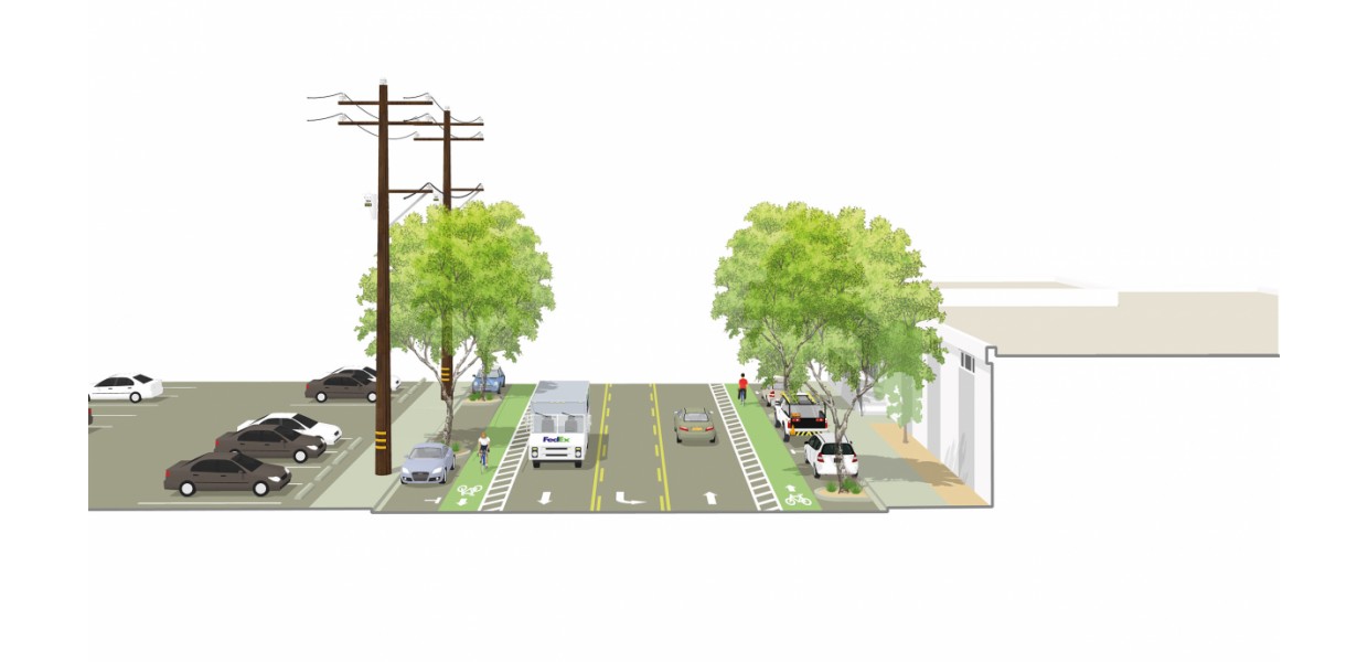
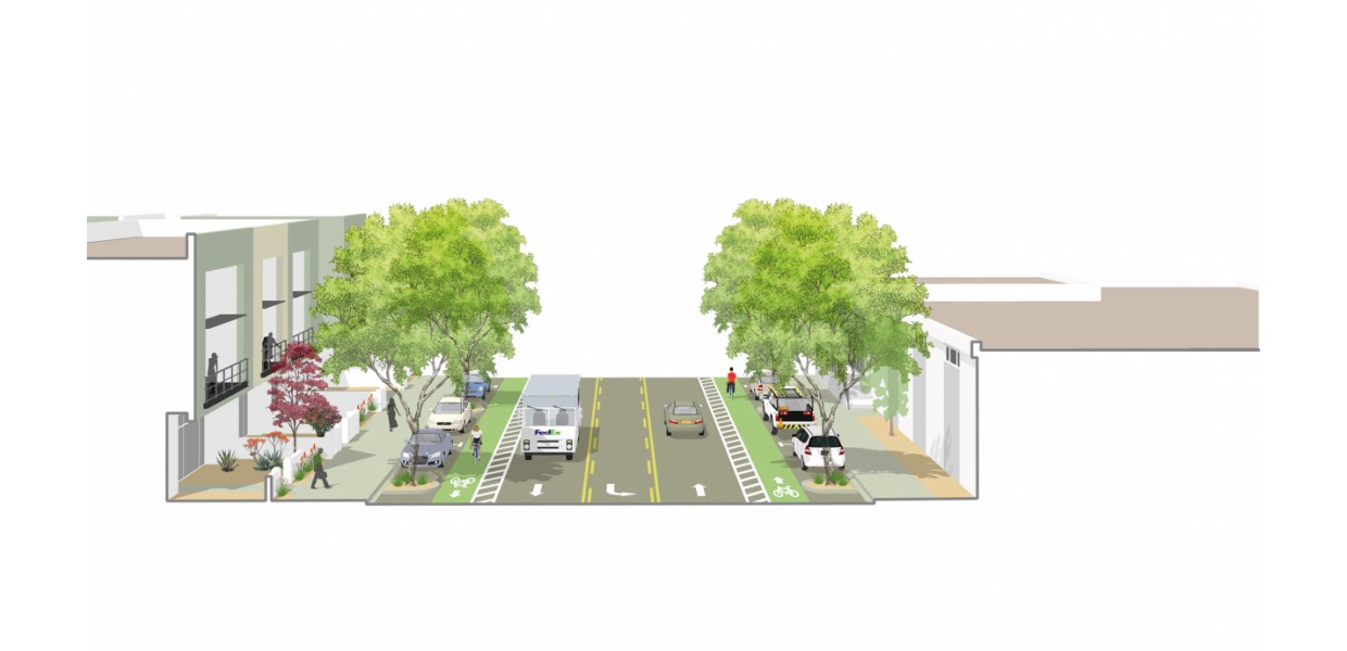
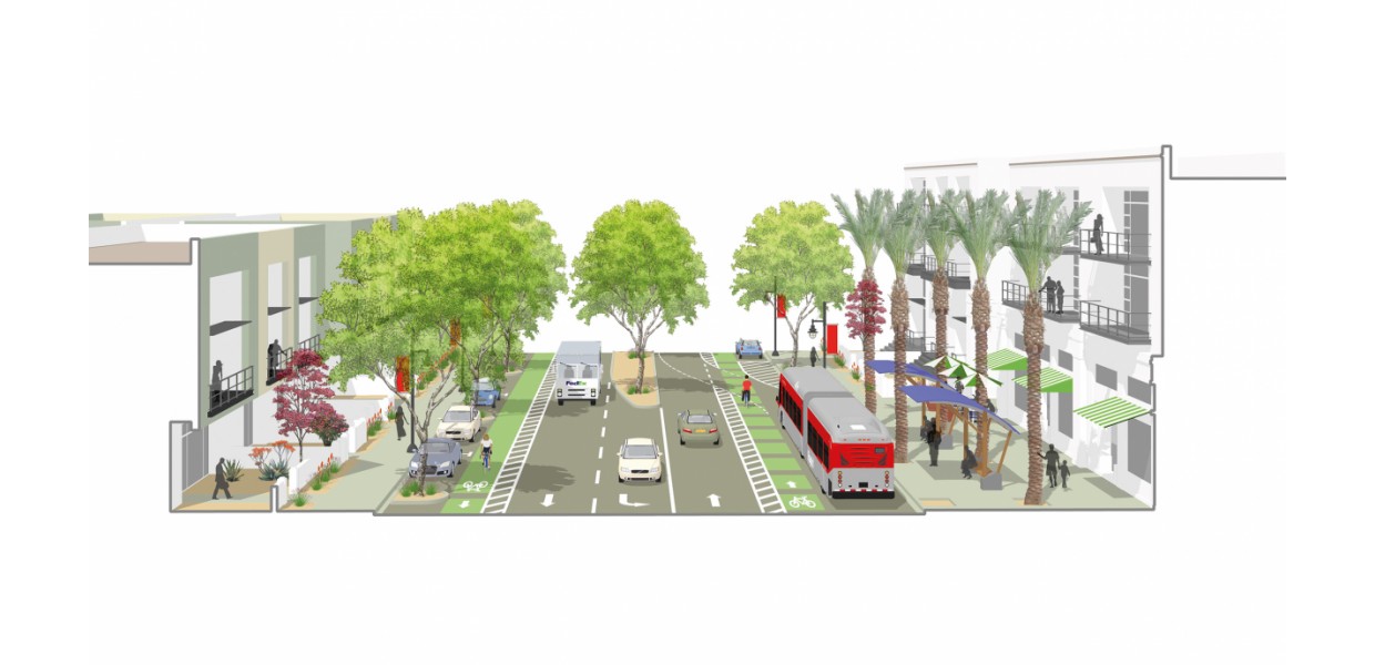
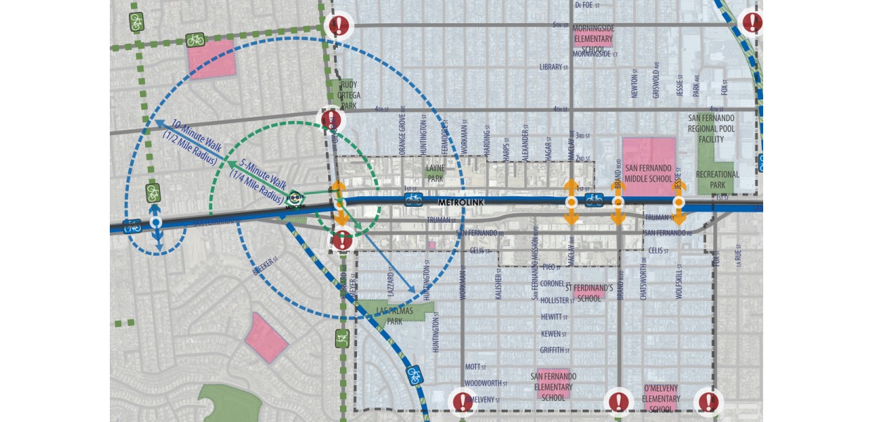
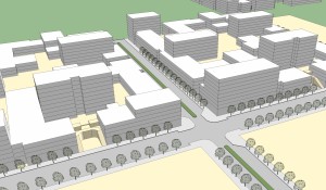
A central focus of the work was developing complete streets strategies to improve the character and quality of the public realm of the downtown and Metrolink Station area, to promote pedestrian safety and comfort and to encourage reinvestment and new high-quality mixed-use development within the area’s many vacant and underutilized properties. Working closely with an ad hoc steering committee and City staff, the team prepared a comprehensive existing conditions report and illustrations of a range of alternative streetscape configurations and with mixed-use infill development possibilities. Through an almost 2-year series of committee meetings and public workshops the alternatives were considered and a preferred alternative finally identified.
Based on that community vision, the STP team - including Nelson/Nygaard and Gibson Transportation Consulting for multi-modal transportation, Raimi + Associates for general plan updates, Metropolitan Research + Economics for market assessment, and Meridian Consultants to prepare an environmental impact report - made extensive revisions to the Downtown Corridors Specific Plan, prepared previously by Freedman, Tung & Bottomley. The updated specific plan includes new form-based development standards for public spaces and private development, and implementation strategies to support downtown revitalization.
The Plan was adopted by the City Council in late 2017, and in May of 2018 was recognized the Southern California Association of Governments (SCAG) with 1 of 6 Sustainability Awards, winning the “Against-All-Odds” award for excellence in implementation while overcoming numerous challenges and constraints.