Lancaster T.O.D. Zones Adopted by City Council
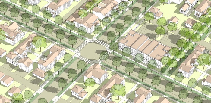
The Lancaster City Council has adopted new transit-oriented development (T.O.D.) zoning that provides development standards, street standards, and architectural guidelines the under-developed area at the east end of their downtown, around the Lancaster Metrolink Station. The new zoning is based on a conceptual station area plan prepared previously by STP, which envisions the largely vacant area being developed as a compact, walkable, transit-oriented mixed-use neighborhood center, anchoring that end of the City's rapidly rebounding Lancaster Boulevard main street. New zoning was also prepared for existing neighborhoods to the north and the west of the station area - to ensure that new infill development and housing renovation enhances their quality - and for the Sierra Highway Corridor to gradually transform it from a highway that cuts the station area off from downtown, to an urban avenue that connects and unifies the two areas.